SBG Systems conducted advanced motion tests to validate inertial navigation performance in dynamic, real-world marine conditions. These tests simulated rapid accelerations, strong vibrations, and sharp rotational movements that vessels experience in busy port environments.
Engineers carefully analyzed the sensor responses during these tests. This data helped them refine calibration models and improve real-time compensation algorithms for better precision. During this campaign, the survey team captured trajectory and bathymetric data near the Hamburg Harbour docks. This area provided ideal conditions due to constant swells caused by passing cargo ships.
Dynamic water movement tested the INS’s stability under varying motion profiles. The inertial sensors successfully recorded data with minimal drift, even during sudden disturbances. The survey vessel used a high-performance SBG Horizon INS system tightly integrated with GNSS for optimal positioning and motion tracking.
Simultaneously, engineers deployed a real-time fiber-optic sensor solution as a reference. This allowed them to evaluate difference surfaces and compare performance in challenging motion scenarios.
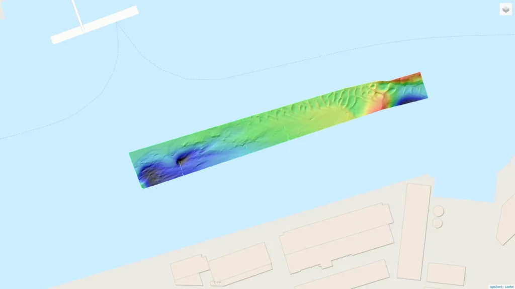
Hamburg docks survey map interface
The resulting Hamburg docks survey map displays trajectory lines, bathymetric surfaces, and quality indicators along the Elbe’s edge near the dock area. Users can analyze how sensor accuracy holds under swell and movement.
Surveyors observed consistent depth measurements, even when external vibrations and waves impacted the vessel’s stability. These results confirmed the robustness of the INS in dynamic maritime environments. The Horizon INS’s performance aligned closely with the fiber-optic reference, validating its use for hydrography, port inspection, and autonomous navigation.
The interactive map enables visitors to explore the Hamburg docks survey area and study the effects of motion on bathymetric accuracy.
We invite hydrographic experts and engineers to examine the data collected during this motion test. The bathymetric map provides valuable insights into sensor behavior in real-time, high-movement conditions. These tests are vital for optimizing navigation systems used in defense, marine science, and autonomous platforms. Motion testing ensures performance when the environment is unpredictable and accuracy cannot be compromised.
How to use the survey map visualization:
1 – One continuous click with 1 finger for a 360º move.
2 – Use trackpad 2 fingers gesture for zoom in/out
3 – Select all features you want to be presented (e.g. colors, survey line, etc.)
Get full access to other SBG Systems’ products test reports.
