
Whether you are hiking through the wilderness or driving down a busy city street, GNSS is a reliable companion that guides you with the utmost accuracy. Although strongly impacted by the Ionospheric activity, so called ionospheric errors. We offer a new solution to correct it: Qinertia with its Ionoshield mode.
Introduction to GNSS
Global Navigation Satellite System (GNSS) refers to a constellation of satellites that provide signals from space that transmit positioning and timing data to GNSS receivers. Agriculture, mapping, transportation, navigation-GNSS technology has a wide range of applications across industries and everyday life.
Some of the most prominent GNSS systems in operation are:
- Global Positioning System or GPS, developed by the US Department of Defense, is a network of satellites orbiting around the Earth. There are currently 30 operational GPS satellites. These satellites continuously transmit signals that contain information about their precise location and time.
- Global Navigation Satellite Systems or GLONASS is a satellite-based navigation system developed by Russia. The system had an initial constellation of 24 satellites.
- Galileo is the European Union’s Global Navigation Satellite System. It aims to provide an independent positioning system for Europe and other regions.
- BeiDou Navigation Satellite System or BDS is China’s GNSS. It initially provided regional coverage, but with the completion of the BeiDou-3 constellation, it now provides global navigation services.
Atmospheric errors
One of the most significant sources of errors in GNSS positioning can be attributed to the atmosphere. Since the satellites and the GNSS signal receivers are located far away, the GNSS signal travels thousands of kilometers between the satellite and the receiver. During this journey, the signal passes through atmospheric layers.
The ionosphere is the layer of the atmosphere between 50 and 1000km above the Earth. This outer layer of Earth contains electrically charged particles called ions. They significantly affect the transmission of the GNSS signal causing its distortion and delay.
Since atmospheric errors are challenging to predict due to their changing nature, it’s difficult to determine their precise impact on calculated positions.
The delays caused by the Ionospheric activity can vary based on:
- The time of the day
- The season of the year
- Geographical location
- The solar activity
Baselines
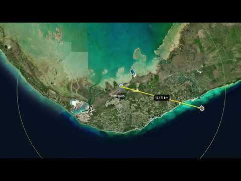
Atmospheric errors also depend on the distance between the reference base station and the rover receiver. The distance between the base station and the rover is known as the baseline. If the baseline errors are not taken into account, they cause significant positioning errors specifically in long baseline applications.
The base station is installed at a precisely known location. It estimates GNSS errors and continually sends corrections to the rover receiver.
The rover receiver then uses this data to correct all errors and calculate the exact position. This works well when the base station and the rover are close.
We know that when several receivers are placed side by side in an open area, they tend to have similar errors. Both the base station and the rover receivers experience the same delay due to ionosphere and therefore have identical errors. This is known as a standard GNSS error.
Thanks to this unique characteristic, we can calculate the relative distance between the receivers more accurately. This makes it easier for systems to correct atmospheric errors.
Why is long baseline in particular interest now?
When the baseline is long, the Ionospheric activity introduces significant discrepancies between the base station and the rover. As solar activity increases, the fluctuations in the ionosphere increase.
Every eleven years, the Sun’s magnetic field completely flips.
This leads to increased solar activity (peak between 2023 and 2025). Many modern correction software packages offer solutions to account for the long baseline and solar activity.
How can GNSS users minimize the impacts of increased ionospheric activity?
To reduce the impacts of increased ionospheric activity on GNSS operations:
- Make sure your GNSS sensors have the most up-to-date software to get the best performance in tracking and positioning with GNSS.
- Make use of various GNSS systems like GPS, GLONASS, Galileo, and Baidu, if they are accessible. This boosts the number of observations used for positioning and brings in a wider range of tracked GNSS signals. More data leads to greater reliability.
- In high-precision surveying tasks, perform two or more measurements at different times and under varying ionospheric conditions.
- Check the current influence of the ionosphere in your area using various GNSS correction service providers.
- Choose a GNSS correction method that matches your requirements.
GNSS error corrections: RTK vs PPK
Imagine a world where everything is perfect: no errors from the devices that receive signals, no problems from the satellites, and no disruptions from the atmosphere. In this ideal world, GNSS could pinpoint locations with incredible precision.
But in reality, there are errors that can happen. There’s a way to reduce these errors. This is what various differential GPS, or DGPS, does. DGPS works by using information from multiple receivers to estimate the errors and removes them.
Applications, like surveying, require higher precision. This depends on the technology and the correction capabilities of the receiver.
Various correction methods can be applied to handle the receiver side error:
- Real-Time Kinematic (RTK)
- Post-Processed Kinematic (PPK)
RTK corrections
RTK uses a reference point, like a base station, which is close to the GPS device we want to know the location of (called a rover).
By knowing where the base station is and using algorithm, RTK can get rid of errors that both the base station and the rover share. These errors can come from the satellites and/or the atmosphere.
To fix errors from the atmosphere, the rover and the base station need to face the same errors. That’s why they have to be close to each other.
Thanks to RTK, the GPS can be accurate up to 1 centimeter. This RTK method is very effective for accurate GPS solutions, especially for land survey.
PPK corrections
PPK allows for accurate post-processing of GNSS data to improve the quality of location information. It is especially valuable in scenarios with challenging GNSS signal conditions, providing more reliable and precise results.
It is widely used in applications such as drone mapping, geodetic surveys, and asset management.
Now the big question is which correction method is the best? This depends on a number of factors like location, baseline length, ionospheric activity, accuracy requirements, reliability, and budget.
RTK and PPK GNSS error correction methods
Let’s compare two of the most popular correction methods:
| Criteria | RTK | PPK |
|---|---|---|
| Data correction | Provides live correction to the location data collected. | Collects whole location data first and provides correction offsite. |
| Post-processing | Does not require post-processing of the data and hence no need to employ a post-processing software. | Requires specialized software. |
| Signal strength between the base station and the rover | Must have constant connection between the base station and the rover receiver. Loss of signal leads to loss of data and hence introduces more errors. | Does not require strong signal strength between the base station and the rover receiver. |
| Working environment | Works best under open sky conditions, when there are no obstructions like trees, buildings, and mountains. When things block the GNSS signals, it’s hard to keep the accuracy reliable. | Maintains decimeter level accuracy even in places with obstacles (tunnels, bridges, valleys). This is possible using algorithmic artifacts such as Backward-Forward processing. |
| Baselines | Works for baselines up to 30 km. | Assess and compensates for ionospheric errors in case of longer baselines. |
| Damaged log recovery | N/A | Can recover a damaged log affected by strong solar activity by using “long baseline a posteriori” |
| Solar activity | Does not consider solar activity while computing data. | Takes into consideration solar activity to decide between Long and Short baseline modes. |