SBG Systems unveils the Channels of Speicherstadt bathymetric 3D model, visualizing underwater topography in Hamburg’s historic warehouse district. The SBG Horizon Inertial Navigation System (INS) captured precise trajectory and depth data along the narrow Speicherstadt channels. Surveyors integrated the INS with a Multibeam Echosounder (MBES) to map riverbed features beneath confined, GNSS-limited urban waterways.
These channels posed challenges like limited satellite coverage, sharp turns, and reflective surfaces during hydrographic operations. Despite these conditions, the Horizon system enabled accurate mapping and reliable motion compensation across the entire survey area.
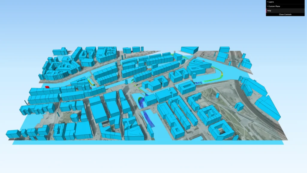
What can you explore in our bathymetric model ?
The 3D bathymetric model displays survey lines, computed bathymetry, quality indicator layers, and topographic features in an interactive web interface. Users can explore and analyze each data layer to assess the survey’s consistency, accuracy, and environmental complexity.
This model allows hydrographers to study navigation system performance in urban, GNSS-degraded areas like the Speicherstadt. Each component of the visualization supports improved sensor integration and workflow optimization for marine and hydrographic professionals. The interface helps identify how high-precision inertial solutions contribute to data quality and reliable underwater mapping results.
We invite surveyors, engineers, and researchers to explore the Speicherstadt bathymetric 3D model in full detail. Use this interactive map to examine the Elbe River’s structure beneath the Speicherstadt’s historic canals and bridges.
The model provides a reference for evaluating inertial sensor performance in challenging and dynamic environments. It also highlights the value of tightly coupled GNSS/INS systems in complex, real-world survey conditions. This survey demonstrates how advanced navigation technologies meet the demands of modern hydrographic and urban mapping missions. Explore the 3D visualization to witness SBG Horizon’s precision in action and assess the quality of the collected data.
How to use the Speicherstadt canals map visualization:
1 – One continuous click with 1 finger for a 360º move.
2 – Use trackpad 2 fingers gesture for zoom in/out
3 – Select all features you want to be presented (e.g. colors, survey line, etc.)
Get full access to other SBG Systems’ products test reports.
