Formula Student: the crucial role of the IMU/GNSS
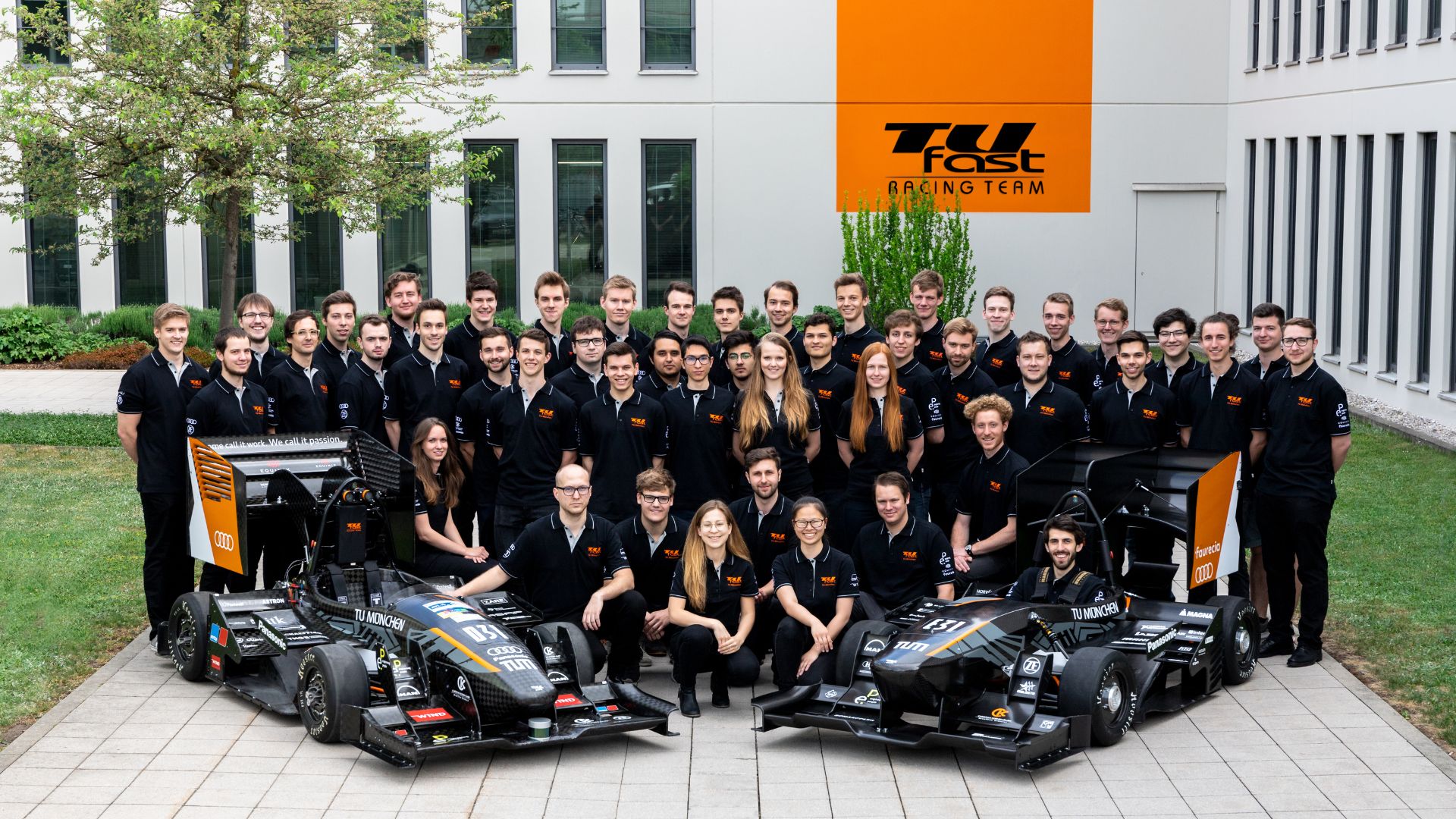
Several electric and driverless teams equipped their race cars with our Ellipse IMU/GNSS during the Formula Student Competition.
The Ellipse-D sensor fulfilled all our needs and we are very happy with it. GNSS is very stable, Kalman Filter also satisfying. | Daniel K., AMZ Racing Electric Team
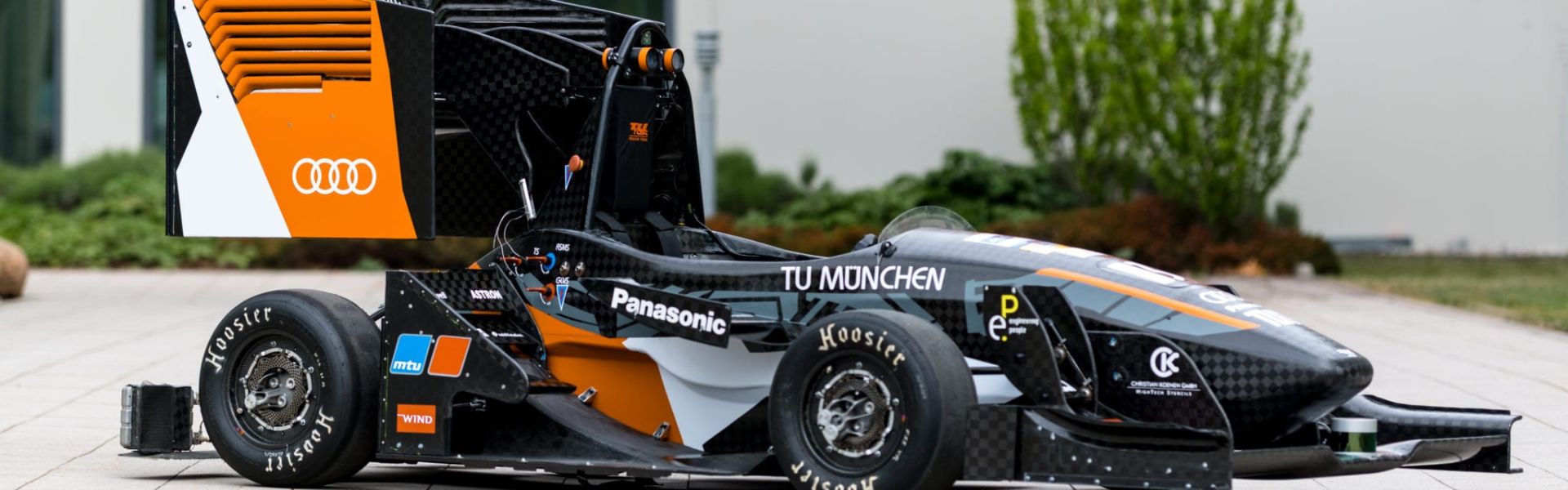
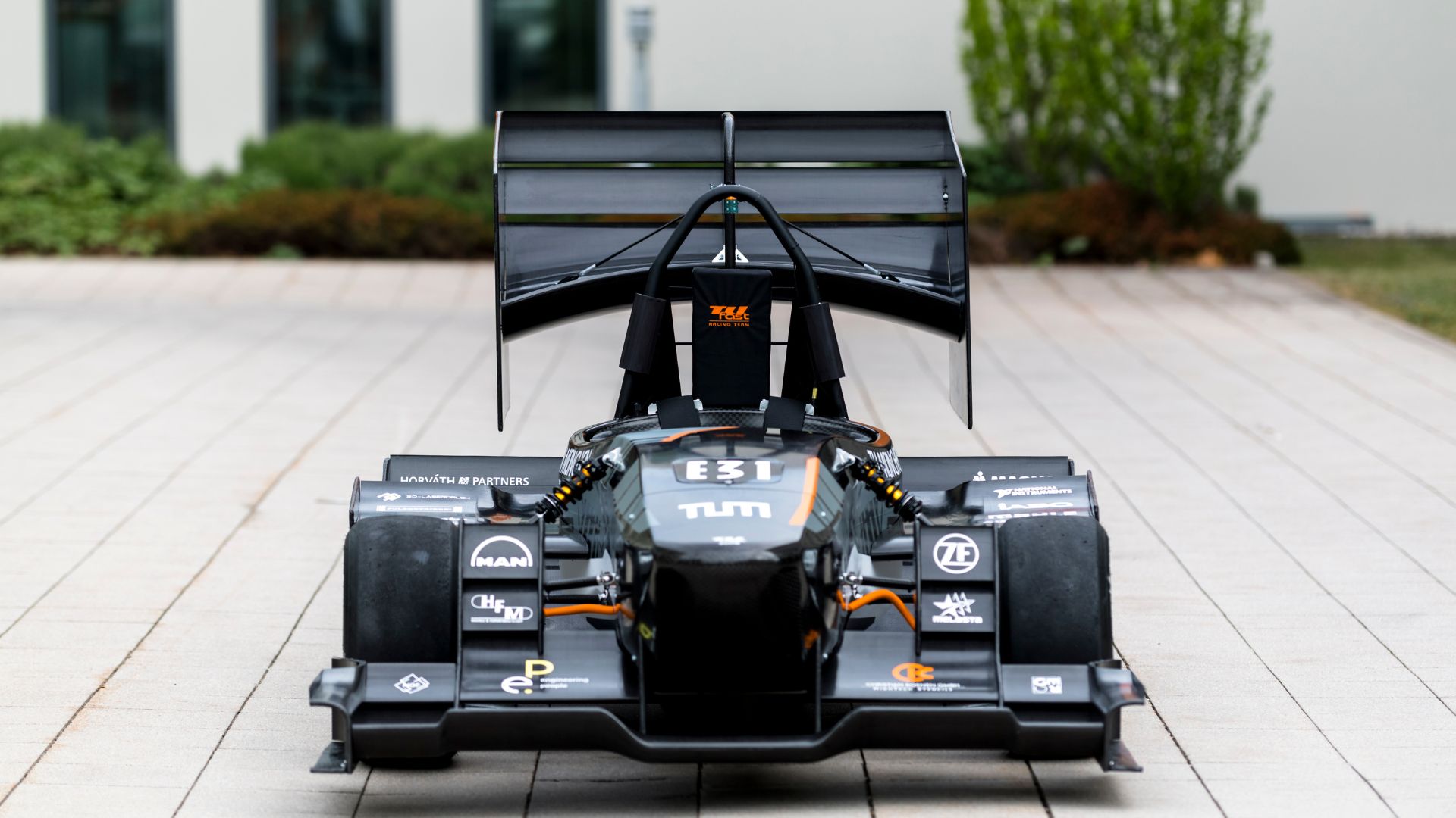
The Formula Student is an international educational engineering competition in which teams of students from around the world design, build, and race their own formula race cars. The competition includes 3 categories: Electric, Driverless, and Combustible cars.
Formula Student participants must not only build the fastest race car but also excel in endurance, acceleration, and skid pad performance.
As an expert in Inertial Navigation Systems and partner of several teams, we interviewed various teams of engineers using our Inertial Measurement Unit (IMU) combined with Global Navigation Satellite System (GNSS) to understand what the key elements to success are.
The Importance of the IMU/GNSS for Precise Car Dynamics
The IMU/GNSS provides decisive information on the car state such as position, speed, yaw rate, slip angle, acceleration and orientation to the competing teams’ cars, as stated by D. Kiesewalter, from AMZ Racing:
“We required an IMU for several reasons. Primarily to determine the position state of our car.We also needed to have efficient dynamics control & a reliable and accurate determination of Euler Angles (roll, pitch, and heading).”
This way, engineers of electric and combustible cars can understand what to improve by comparing the actual state to the theoretical one.
Formula Student car dynamics criteria
Mastering acceleration is primordial during Formula races. When the car accelerates too much, it can drift, which causes the wheels to wear out. To minimize tire wear and get the most of the engine’s power and performance, acceleration has to be checked.
Tracking the race car trajectory is essential. A circuit analysis is conducted thanks to the IMU/GNSS data, especially position, and helps determine if the car is well positioned inside the circuit or when turning.
Let’s not forget that the Formula Student is a race. One of the competition goals is to go faster on the track than the other teams. Speed is therefore a crucial factor to study, thanks to the IMU/GNSS. But it is even more important for electric race cars, as they need to track the consumed energy.
Driverless race cars: Taking the best of Heading and Navigation out of the IMU/GNSS
Racing cars may use single-antenna GPS for heading, but driverless vehicles rely on dual-antenna IMU/GNSS for precise heading. It allows faster initialization and delivers true heading even in stationary position.
J. Liberal Huarte from UPC Driverless (ETSEIB) explains that heading and localization are essential for other parts of the equipment to function properly: “When we operate with LiDAR technologies, the fact that you are headed 1 degree to one side or the other influences a lot the position.
So, precise heading is a big requirement. And also, localization and mapping: it is very important to localize yourself in the X, Y.” Therefore, implementing a Dual GNSS/IMU in this type of race car is the best solution, as it provides true heading and position, which also helps stabilize the LiDAR.
Heading is as important as precise navigation for driverless race cars. Real Time Kinematic (RTK) allows an extremely accurate estimation of the position (1-2 cm). The more accurate the IMU/GNSS is, the more the car is able to stay in the circuit lane without drifting.
The IMU/GNSS analyzes the circuit to ensure optimal car positioning and trajectory optimization.
Less implementation time = more time for the whole project
“We have very small test time, so if it goes fast, we can go faster on the track and test more”, states A. Kopp, Vehicle Dynamics Control, TUfast Racing.
Teams don’t have much time to integrate the different parts of the vehicle and to test them. As CAN and ROS framework are mainly used by automobile engineers, IMU/GNSS that can be part of such workflows can save tremendous time of development.
A clean C library provided with examples is another way to help teams with their integration.
SBG Systems supports new ways to design cars
Students are welcome to send their sponsorship application through our website!
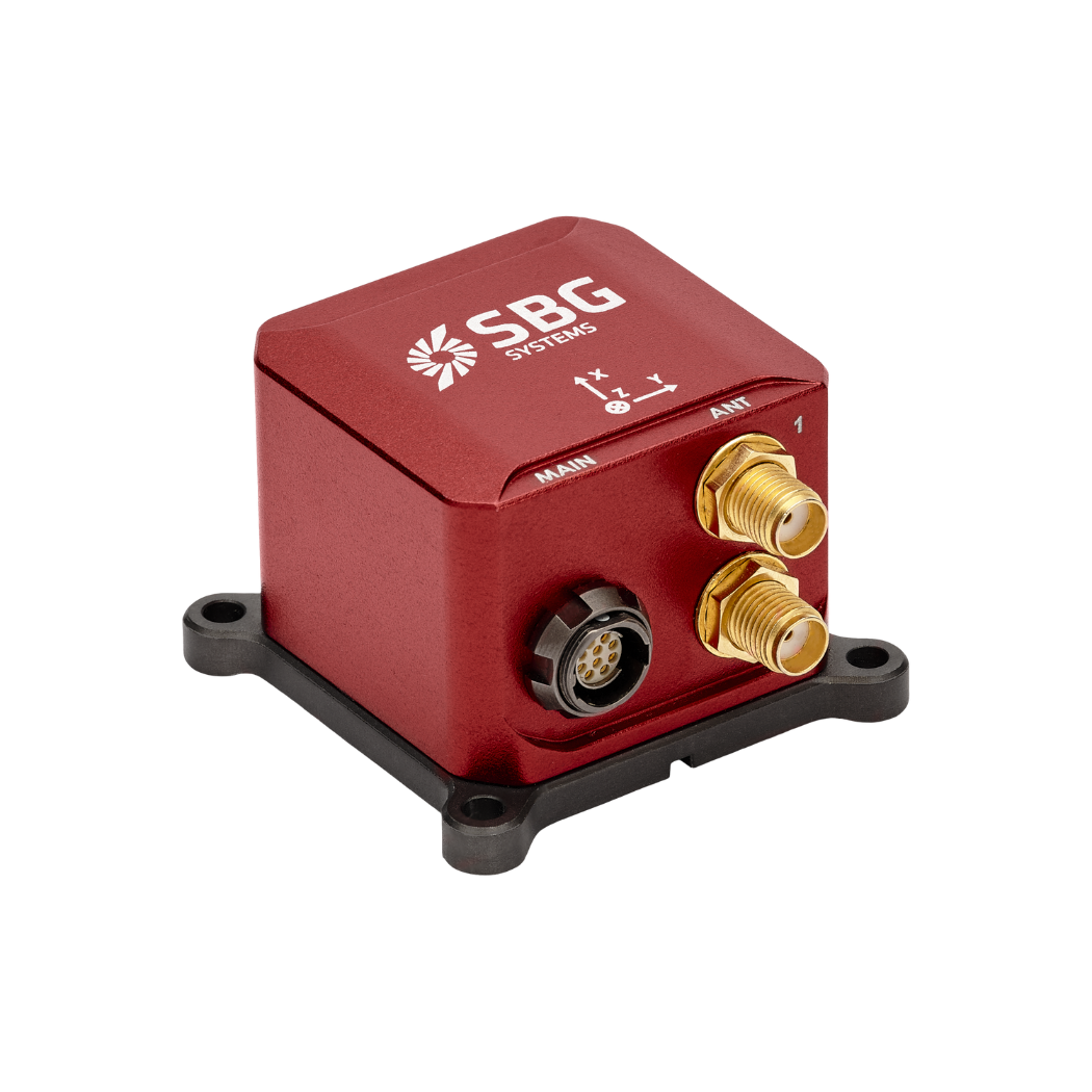
Ellipse-D
The Ellipse-D is an inertial navigation system integrating a dual antenna and dual frequency RTK GNSS that is compatible with our Post-Processing software Qinertia.
Designed for robotic and geospatial applications, it can fuse Odometer input with Pulse or CAN OBDII for enhanced dead-reckoning accuracy.
Ask a quotation for Ellipse-D
Do you have questions?
Welcome to our FAQ section! Here, you’ll find answers to the most common questions about the applications we showcase. If you don’t find what you’re looking for, feel free to contact us directly!
What is GNSS vs GPS?
GNSS stands for Global Navigation Satellite System and GPS for Global Positioning System. These terms are often used interchangeably, but they refer to different concepts within satellite-based navigation systems.
GNSS is a collective term for all satellite navigation systems, while GPS refers specifically to the U.S. system. It includes multiple systems that provide more comprehensive global coverage, while GPS is just one of those systems.
You get improved accuracy and reliability with GNSS, by integrating data from multiple systems, whereas GPS alone might have limitations depending on satellite availability and environmental conditions.
What is the difference between AHRS and INS?
The main difference between an Attitude and Heading Reference System (AHRS) and an Inertial Navigation System (INS) lies in their functionality and the scope of the data they provide.
AHRS provides orientation information—specifically, the attitude (pitch, roll) and heading (yaw) of a vehicle or device. It typically uses a combination of sensors, including gyroscopes, accelerometers, and magnetometers, to calculate and stabilize the orientation. The AHRS outputs the angular position in three axes (pitch, roll, and yaw), allowing a system to understand its orientation in space. It is often used in aviation, UAVs, robotics, and marine systems to provide accurate attitude and heading data, which is critical for vehicle control and stabilization.
A INS not only provides orientation data (like an AHRS) but also tracks a vehicle’s position, velocity, and acceleration over time. It uses inertial sensors to estimate movement in 3D space without relying on external references like GNSS. It combines the sensors found in AHRS (gyroscopes, accelerometers) but may also include more advanced algorithms for position and velocity tracking, often integrating with external data like GNSS for enhanced accuracy.
In summary, AHRS focuses on orientation (attitude and heading), while INS provides a full suite of navigational data, including position, velocity, and orientation.
What is the difference between IMU and INS?
The difference between an Inertial Measurement Unit (IMU) and an Inertial Navigation System (INS) lies in their functionality and complexity.
An IMU (inertial measuring unit) provides raw data on the vehicle’s linear acceleration and angular velocity, measured by accelerometers and gyroscopes. It supplies information on roll, pitch, yaw, and motion, but does not compute position or navigation data. The IMU is specifically designed to relay essential data about movement and orientation for external processing to determine position or velocity.
On the other hand, an INS (inertial navigation system) combines IMU data with advanced algorithms to calculate a vehicle’s position, velocity, and orientation over time. It incorporates navigation algorithms like Kalman filtering for sensor fusion and integration. An INS supplies real-time navigation data, including position, velocity, and orientation, without relying on external positioning systems like GNSS.
This navigation system is typically utilized in applications that require comprehensive navigation solutions, particularly in GNSS-denied environments, such as military UAVs, ships, and submarines.
Does INS accept inputs from external aiding sensors?
Inertial Navigation Systems from our company accept inputs from external aiding sensors, such as air data sensors, magnetometers, Odometers, DVL and other.
This integration makes the INS highly versatile and reliable, especially in GNSS-denied environments.
These external sensors enhance the overall performance and accuracy of the INS by providing complementary data.