Jan De Nul select Navsight to ease hydrographers’ tasks
“SBG Navsight-Apogee gives us the confidence of reliable surveys in challenging conditions, maximising our operating window in near and offshore waters. “ | Nils Lowie, Senior Survey Engineer, Jan De Nul.
Jan De Nul Group is a renowned international player in maritime operations, specialized in offshore energy, dredging solutions, construction projects, circular solutions and project development.
They employ advanced precision technologies to shape water and land with accuracy, efficiency, and reliability in its operations.
Jan De Nul’s objectives
- Reduce environmental footprint: Minimize emissions and environmental impact associated with maritime survey operations.
- Ensure survey reliability: Obtain accurate and reliable survey data even in harsh offshore conditions, including high seas and wind farm environments.
- Enhance operational efficiency: Optimize USV’s operational window and data collection capabilities for increased productivity.
Requirements from Inertial Navigation System provider
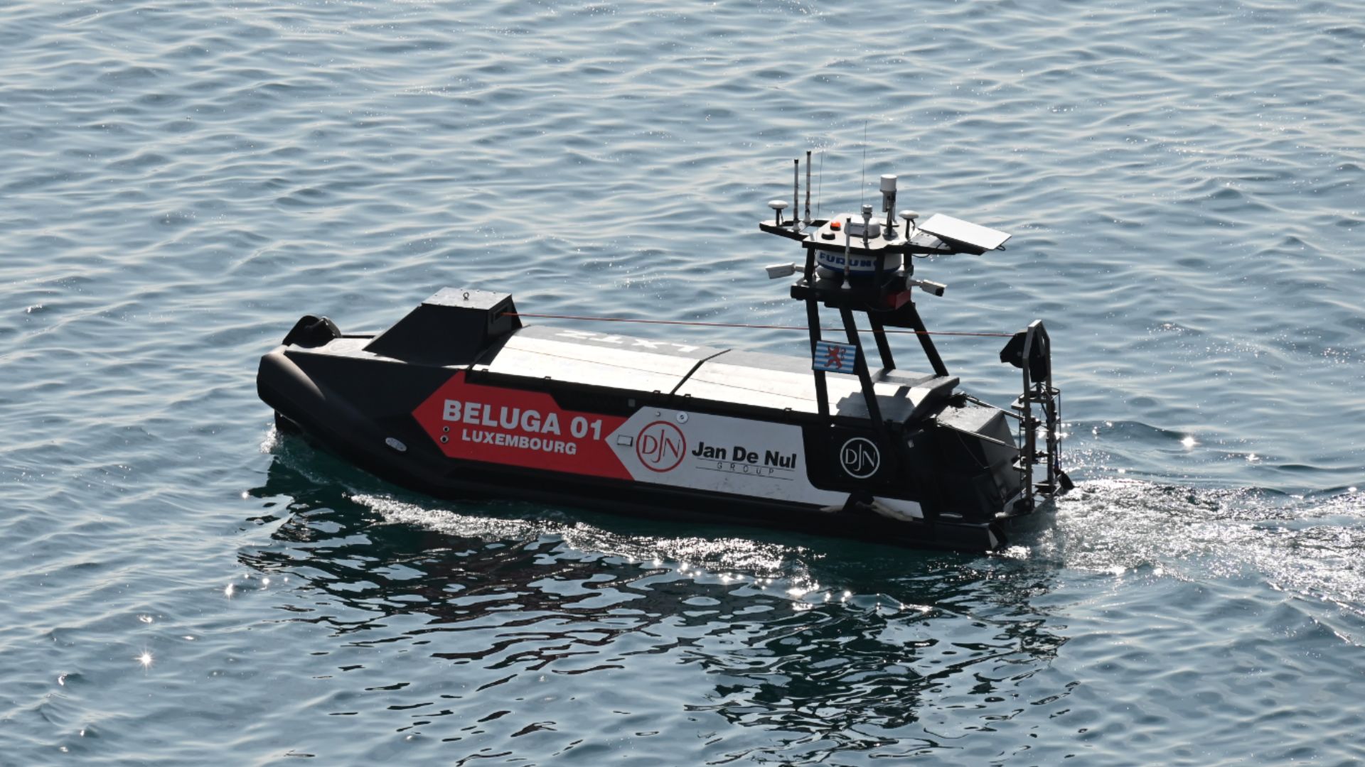
Jan De Nul was looking for a reliable Inertial Navigation System (INS) solution for its hybrid maritime Unmanned Surface Vehicle (USV), Beluga 01. The USV offers a greener alternative to conventional boats for bathymetric surveys with reduced environmental impact and increased operational efficiency.
The company had specific technical requirements, including the need for accurate Pitch, Roll, and Heave (P/R/H) measurements, a small form factor for pole installations, a user-friendly interface and installation process, and reliable performance.
Navsight-Apogee, a survey-grade Motion Reference Unit (MRU) from SBG Systems, ensures reliable performance as a key component.
Beginning of engagement
The engagement started with an in-depth testing of our Navsight-Apogee products at the customer’s side. During this phase, we discussed results and identified any shortcomings related to Jan De Nul’s specific business needs.
Product integration
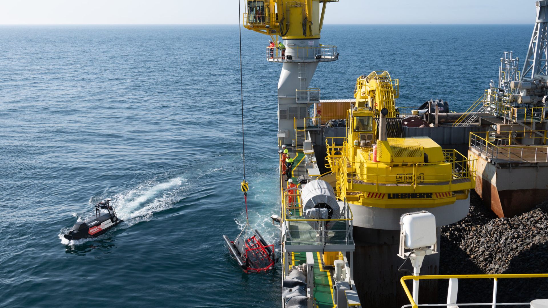
After a thorough analysis, Jan De Nul integrated Navsight-Apogee into its survey vessel for bathymetric applications. The integration of Navsight-Apogee provided an optimal solution to address customer’s objectives:
- Reliable data in harsh conditions: Navsight-Apogee ensured consistent and accurate survey data even in sea state three conditions, maximizing the operational window of the USV.
- Enhanced positioning: By integrating GNSS data with the MRU, Apogee provided precise positioning at all times, overcoming the limitations of GNSS availability in wind farm environments.
- Compact design: The small form factor and waterproof enclosure of Apogee allowed for seamless integration into the limited space of the USV’s moon pool, ensuring efficient use of space.
Support and assistance
Throughout the integration phase, Jan De Nul received support from SBG Systems‘ team. They contacted our support team whenever they needed help, and promptly received responses to resolve issues or answer questions.
While Navsight-Apogee met many of Jan De Nul’s application requirements, continuous improvements were identified to further enhance performance and functionality.
Conclusion
As both companies continue to innovate, the partnership remains primary for continued success in the maritime infrastructure sector.
Navsight-Apogee’s seamless integration with the Beluga 01 USV proves advanced technology makes maritime operations eco-friendly, reliable, and efficient.
Companies embracing smart solutions navigate towards a cleaner, smoother future in marine surveying, effortlessly meeting current demands.
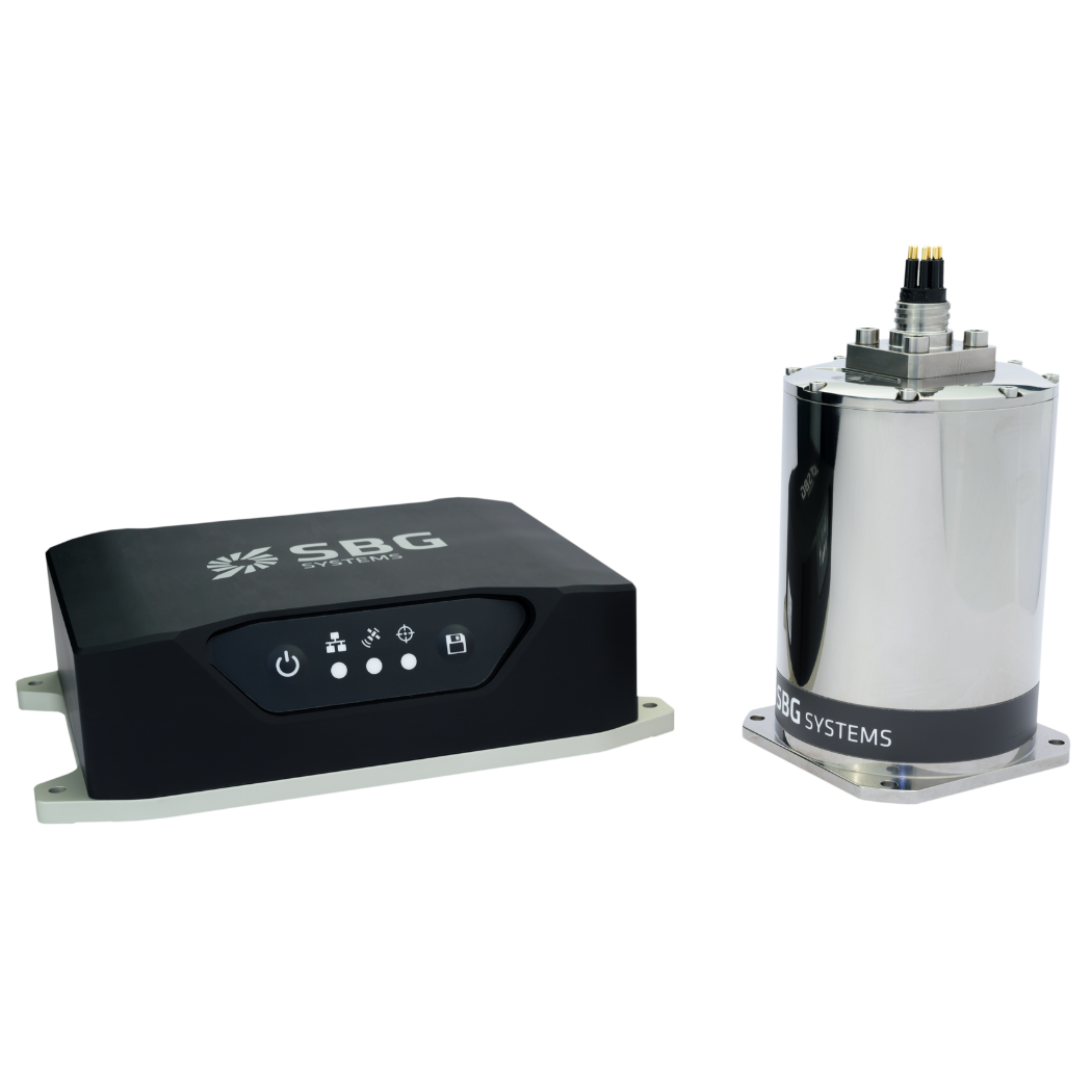
Navsight Apogee Marine
Highly Versatile, Navsight Apogee grade delivers the best performance under GNSS outages, making it ideal for challenging Shallow to Deepwater applications.
Navsight Apogee consists of an Apogee grade Inertial Measurement Unit and connected to Navsight, a rugged processing unit embedding the fusion intelligence and the GNSS receiver (option).
Ask a quotation for Navsight Apogee Marine
Do you have questions?
Welcome to our FAQ section! Here, you’ll find answers to the most common questions about the applications we showcase. If you don’t find what you’re looking for, feel free to contact us directly!
What are wave measurement sensors?
Wave measurement sensors are essential tools for understanding ocean dynamics and improving safety and efficiency in marine operations. By providing accurate and timely data on wave conditions, they help inform decisions across various sectors, from shipping and navigation to environmental conservation.
Wave buoys are floating devices equipped with sensors to measure wave parameters such as height, period, and direction.
They typically use accelerometers or gyroscopes to detect wave motion and can transmit real-time data to shore-based facilities for analysis.
What is bathymetry?
Bathymetry is the study and measurement of the depth and shape of underwater terrain, primarily focused on mapping the seafloor and other submerged landscapes. It is the underwater equivalent of topography, providing detailed insights into the underwater features of oceans, seas, lakes, and rivers. Bathymetry plays a crucial role in various applications, including navigation, marine construction, resource exploration, and environmental studies.
Modern bathymetric techniques rely on sonar systems, such as single-beam and multibeam echo sounders, which use sound waves to measure water depth. These devices send sound pulses toward the seafloor and record the time it takes for the echoes to return, calculating depth based on the speed of sound in water. Multibeam echo sounders, in particular, allow for wide swaths of the seafloor to be mapped at once, providing highly detailed and accurate seafloor representations.
Bathymetric data is essential for creating nautical charts, which help guide vessels safely by identifying potential underwater hazards like submerged rocks, wrecks, and sandbanks. It also plays a vital role in scientific research, helping researchers understand underwater geological features, ocean currents, and marine ecosystems.
What is a buoy used for?
A buoy is a floating device primarily used in maritime and water-based environments for several key purposes. Buoys are often placed in specific locations to mark safe passages, channels, or hazardous areas in bodies of water. They guide ships and vessels, helping them avoid dangerous spots like rocks, shallow waters, or wrecks.
They are used as anchoring points for vessels. Mooring buoys allow boats to tie up without having to drop anchor, which can be especially useful in areas where anchoring is impractical or damaging to the environment.
Instrumented buoys are equipped with sensors to measure environmental conditions like temperature, wave height, wind speed, and atmospheric pressure. These buoys provide valuable data for weather forecasting, climate research, and oceanographic studies.
Some buoys act as platforms for collecting and transmitting real-time data from the water or seabed, often used in scientific research, environmental monitoring, and military applications.
In commercial fishing, buoys mark the location of traps or nets. They also help in aquaculture, marking the locations of underwater farms.
Buoys can also mark designated areas such as no-anchoring zones, no-fishing zones, or swimming areas, helping enforce regulations on the water.
In all cases, buoys are critical for ensuring safety, facilitating marine activities, and supporting scientific research.
What is buoyancy?
Buoyancy is the force exerted by a fluid (such as water or air) that opposes the weight of an object submerged in it. It allows objects to float or rise to the surface if their density is less than that of the fluid. Buoyancy occurs because of the difference in pressure exerted on the object’s submerged portions—greater pressure is applied at lower depths, creating an upward force.
The principle of buoyancy is described by Archimedes’ principle, which states that the upward buoyant force on an object is equal to the weight of the fluid displaced by the object. If the buoyant force is greater than the object’s weight, it will float; if it is less, the object will sink. Buoyancy is essential in many fields, from marine engineering (designing ships and submarines) to the functionality of floating devices like buoys.
