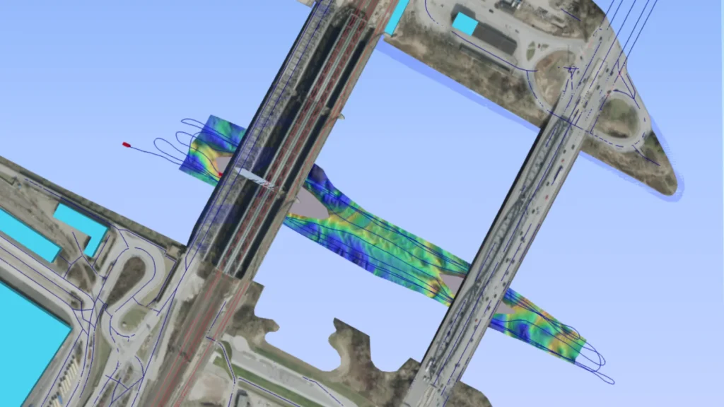
SBG Systems presents the Elbbrücken bathymetric 3D model, a high-resolution visualization of the riverbed beneath the iconic Elbbrücken bridges in Hamburg, Germany. This detailed bathymetric dataset was generated from trajectory data collected using the SBG Horizon, a tightly coupled Inertial Navigation System (INS) renowned for delivering reliable, high-accuracy navigation in dynamic marine environments.
The 3D model captures a comprehensive view of the Elbe River’s underwater landscape in the vicinity of the Elbbrücken, providing not only detailed bathymetry but also crucial metadata such as survey lines, quality indicators, and topographic features. These data layers allow users to evaluate the precision and consistency of the bathymetric surface generated during the survey, making the visualization a valuable tool for hydrographers, engineers, and researchers alike.
This survey was carried out in a challenging urban river environment, characterized by strong currents, GNSS intermittence, and reflective surfaces. By leveraging the performance of the SBG Horizon in combination with post-processed GNSS corrections, the team achieved precise positioning and motion compensation throughout the mission. The result is a clean and accurate model that reflects real-world underwater conditions with minimal distortion.
Our Elbbrücken 3D webmap interface allows users to interact with the survey data directly. From visualizing the trajectory of the survey vessel to examining quality layers that highlight positional accuracy and data consistency, the interface provides an intuitive way to analyze the performance of high-end navigation solutions in complex environments.
We invite hydrographic professionals, to explore the Elbbrücken bathymetric 3D model. This interactive visualization offers a first-hand look at how cutting-edge inertial and GNSS technologies combine to produce actionable, high-fidelity bathymetric maps. As a reference dataset, it also serves as a benchmark for validating sensor performance and data processing workflows in similar riverine or port survey scenarios.
How to use the 3D bathymetric map visualization:
1 – One continuous click with 1 finger for a 360º move.
2 – Use trackpad 2 fingers gesture for zoom in/out
3 – Select all features you want to be presented (e.g. colors, survey line, etc.)
Get full access to other SBG Systems’ products test reports.
