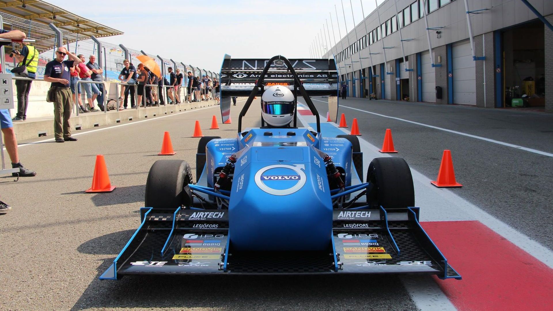
Formula student driverless – Chalmers Team
Chalmers University of Technology equipped their driverless car with the Ellipse-N INS GNSS.
“We were very happy with the performance and robustness of the sensor.” | Emil R. engineering manager with the Chalmers Formula Student Driverless

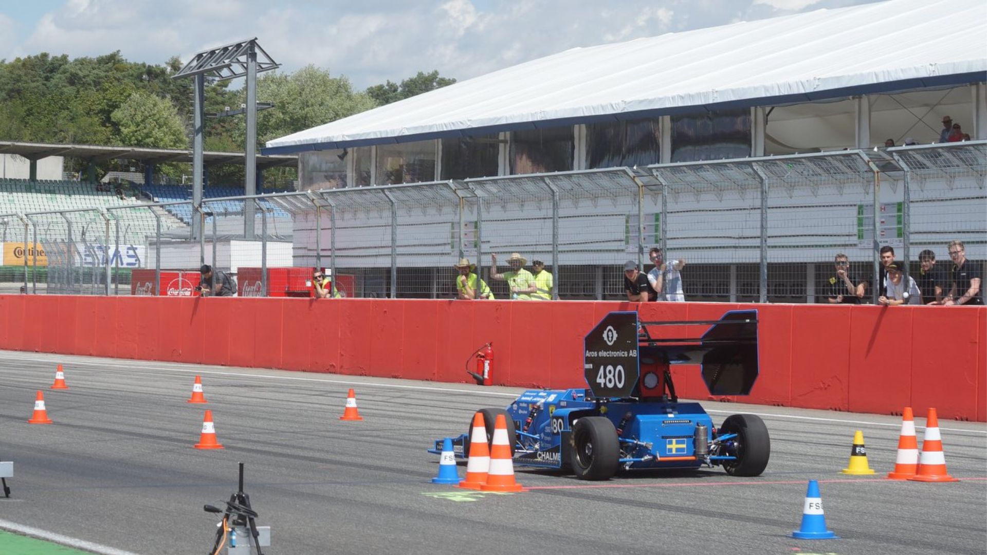
Formula student driverless competition
The formula student driverless competition includes several different challenges: braking, acceleration, skidpad testing and a track drive.
Chalmers University of Technology, a Swedish university which focuses on research and education in technology, participated to the 2018 edition.
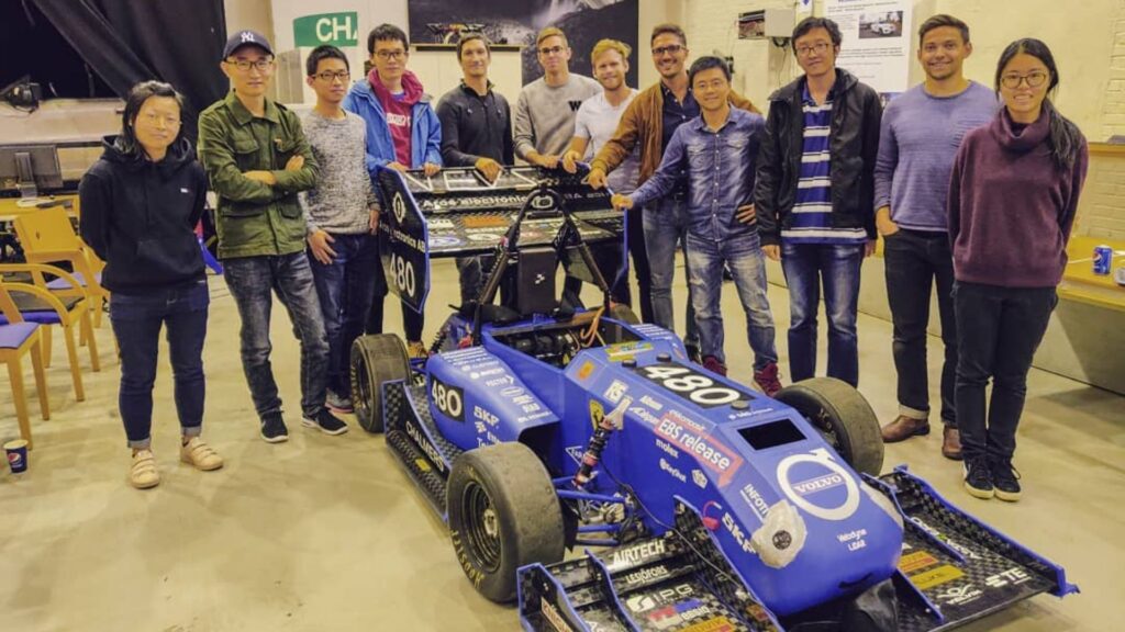
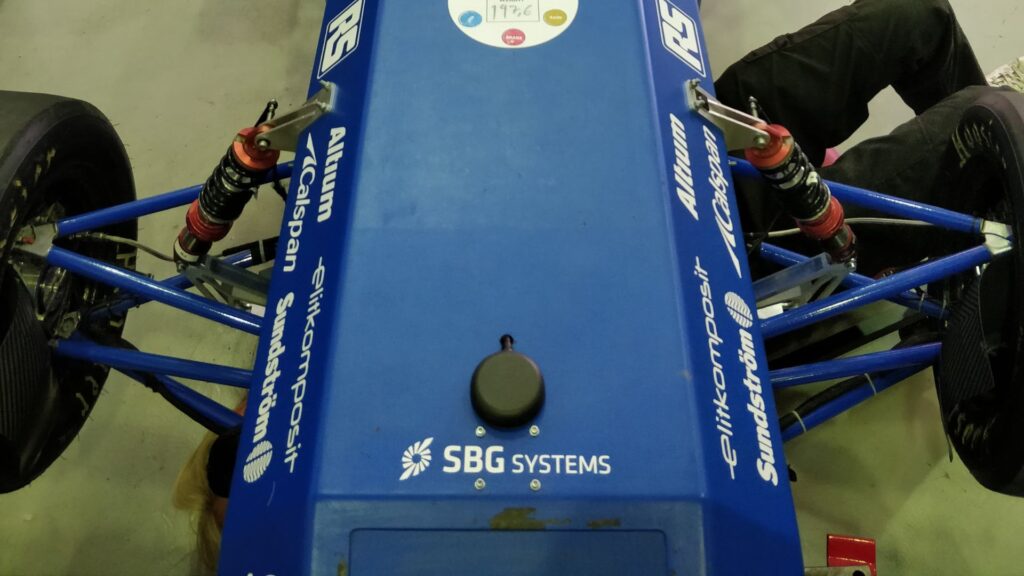
The Chalmers team has equipped their driverless car with the Ellipse-N, a miniature inertial navigation system with embedded GNSS receiver.
Robust and stable Inertial Navigation Sensor
We were very happy with the performance and robustness of the sensor. The sensor did not have any apparent errors during the hundreds of hours of testing we performed.
We did not experience any drifting for the inertial sensors and we were especially impressed by the excellent yaw rate estimation. The GNSS system was also very robust and stable and we never experienced any problems with lacking GNSS coverage and we always had a good number of satellites.
Easy-to-integrate thanks to the C library
The Ellipse-N was very easy to integrate into our own software framework by using the provided C library. Our framework used microservices hosted in Docker containers where the data from the sensor was read by one microservice.
This meant that it was important that the microservice could be built automatically and seamlessly. By the provided library it was simple to include the necessary code into the Docker image and build it together with our own code interfacing the library.
If there would only have been a provided binary instead we would have had to read and parse the raw sensor data ourselves so the library was very useful for our case. The examples and documentation provided made it very easy to use the library and interface the Ellipse-N into the microservice we needed.
Single or dual antenna for such conditions?
If a single antenna Inertial Navigation System (INS) like the Ellipse-N provides very accurate orientation and navigation data, a dual antenna INS such as the Ellipse-D allows a faster initialization, even in a static position.
Such features are to be considered when choosing your INS. Find more information about « how to choose the best heading method ».
“We did not experience any drifting for the inertial sensors and we were especially impressed by the excellent yaw rate estimation.” | Emil R., Engineering Manager
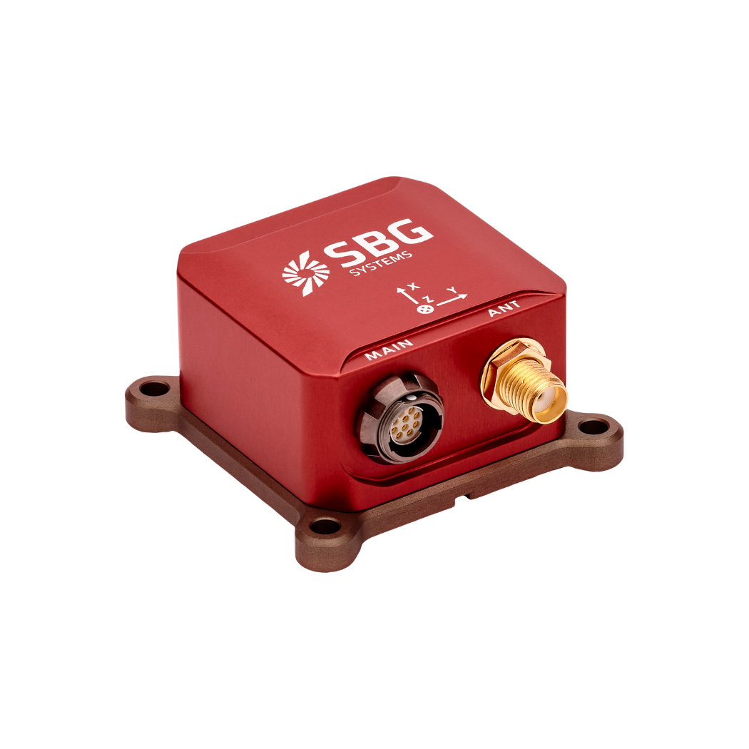
Ellipse-N
Ellipse-N is a compact and high-performance RTK Inertial Navigation System (INS) with an integrated Dual band, Quad Constellations GNSS receiver. It provides roll, pitch, heading, and heave, as well as a centimetric GNSS position.
Ellipse-N sensor is best suited for dynamic environments, and harsh GNSS conditions, but can also operate in lower dynamic applications with a magnetic heading.
Ask a quotation for Ellipse-N
Do you have questions?
Welcome to our FAQ section! Here, you’ll find answers to the most common questions about the applications we showcase. If you don’t find what you’re looking for, feel free to contact us directly!
What is GNSS vs GPS?
GNSS stands for Global Navigation Satellite System and GPS for Global Positioning System. These terms are often used interchangeably, but they refer to different concepts within satellite-based navigation systems.
GNSS is a collective term for all satellite navigation systems, while GPS refers specifically to the U.S. system. It includes multiple systems that provide more comprehensive global coverage, while GPS is just one of those systems.
You get improved accuracy and reliability with GNSS, by integrating data from multiple systems, whereas GPS alone might have limitations depending on satellite availability and environmental conditions.
GNSS represents the broader category of satellite navigation systems, including GPS and other systems, while GPS is a specific GNSS developed by the United States.
What is the difference between AHRS and INS?
The main difference between an Attitude and Heading Reference System (AHRS) and an Inertial Navigation System (INS) lies in their functionality and the scope of the data they provide.
AHRS provides orientation information—specifically, the attitude (pitch, roll) and heading (yaw) of a vehicle or device. It typically uses a combination of sensors, including gyroscopes, accelerometers, and magnetometers, to calculate and stabilize the orientation. The AHRS outputs the angular position in three axes (pitch, roll, and yaw), allowing a system to understand its orientation in space. It is often used in aviation, UAVs, robotics, and marine systems to provide accurate attitude and heading data, which is critical for vehicle control and stabilization.
A INS not only provides orientation data (like an AHRS) but also tracks a vehicle’s position, velocity, and acceleration over time. It uses inertial sensors to estimate movement in 3D space without relying on external references like GNSS. It combines the sensors found in AHRS (gyroscopes, accelerometers) but may also include more advanced algorithms for position and velocity tracking, often integrating with external data like GNSS for enhanced accuracy.
In summary, AHRS focuses on orientation (attitude and heading), while INS provides a full suite of navigational data, including position, velocity, and orientation.
What is the difference between IMU and INS?
The difference between an Inertial Measurement Unit (IMU) and an Inertial Navigation System (INS) lies in their functionality and complexity.
An IMU (inertial measuring unit) provides raw data on the vehicle’s linear acceleration and angular velocity, measured by accelerometers and gyroscopes. It supplies information on roll, pitch, yaw, and motion, but does not compute position or navigation data. The IMU is specifically designed to relay essential data about movement and orientation for external processing to determine position or velocity.
On the other hand, an INS (inertial navigation system) combines IMU data with advanced algorithms to calculate a vehicle’s position, velocity, and orientation over time. It incorporates navigation algorithms like Kalman filtering for sensor fusion and integration. An INS supplies real-time navigation data, including position, velocity, and orientation, without relying on external positioning systems like GNSS.
This navigation system is typically utilized in applications that require comprehensive navigation solutions, particularly in GNSS-denied environments, such as military UAVs, ships, and submarines.
Does INS accept inputs from external aiding sensors?
Inertial Navigation Systems from our company accept inputs from external aiding sensors, such as air data sensors, magnetometers, Odometers, DVL and other.
This integration makes the INS highly versatile and reliable, especially in GNSS-denied environments.
These external sensors enhance the overall performance and accuracy of the INS by providing complementary data.
