Optimization of high-precision observations of wind conditions
” The exceptional quality and performance of SBG Systems’ INS Ellipse-D gives us the confidence of reliable measurement in challenging conditions. In addition, the outstanding support and professionalism of their sales and support teams has been helpful.” | Jun-ichi Furumoto, President, Representative Director CEO

Business overview
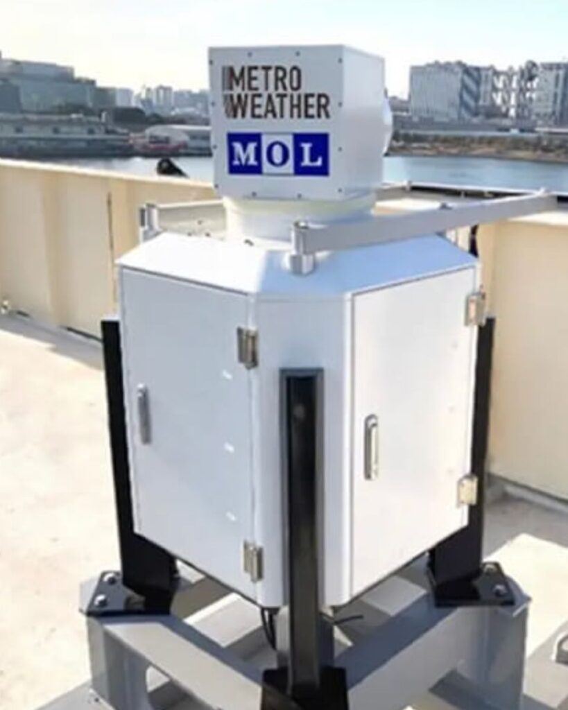
Metro Weather specializes in high-precision wind condition observation using remote sensing technology, predictive wind condition simulation, and unidentified drone detection and recognition. Its flagship product, an ultra-high resolution Doppler LiDAR, provides accurate measurements of wind speed and direction, essential for predicting weather-related risks and enhancing safety.
Metro Weather’s product and working principle
Metro Weather provides “high precision wind condition observation” using its ultra-high resolution Doppler LiDAR. This advanced technology uses the Doppler effect, a phenomenon where the frequency of a wave changes when it hits a moving object.
The Doppler LiDAR emits a laser into the atmosphere that interacts with aerosols (such as dust and fine particles like PM2.5). By detecting the frequency shift (Doppler shift) in the reflected light from these aerosols, the device can determine their speed. Since these particles move with the wind, their velocity is directly equal to the wind movement.
This precise measurement capability allows Metro Weather to:
- Avoid flight routes with gusty winds, thereby improving aviation safety.
- Detect convergence of winds. This helps in predicting severe weather events such as guerrilla downpours, reducing weather-related disasters.
- Detect objects, thus extending the utility of the technology beyond wind detection to identify and track objects.
Applications
Applications for this integrated technology span a number of sectors, including:
- Real-time wind condition observation for the aeronautical and defense industries.
- Environmental monitoring and green technology initiatives.
- Supporting major events such as EXPO 2025 Osaka, Kansai, Japan, where real-time wind speed and direction observations are critical.
Metro Weather’s technical requirements
Metro Weather’s Doppler LiDAR technology relies on precise measurement and adjustment capabilities to operate effectively, especially when installed on moving platforms. Specific requirements for the integration of their Doppler LiDAR technology with our INS included:
- GPS/GNSS positioning: To ensure accurate location tracking.
- GPS/GNSS timing: To synchronize data collection.
- Speed of movement acquisition: Critical for moving installations to adjust wind speed readings.
- Tilt detection: To compensate for movement and maintain accurate beam alignment.
- Ethernet Support: For seamless data transfer.
- OS compatibility: Strong support for Linux/Mac.
Engagement and product integration
At SBG Systems, we prioritize collaboration and innovation to ensure a smooth integration process for our advanced navigation solutions.
From initial consultation to full deployment, our team works closely with you to tailor our products to your specific needs.
Initial engagement between SBG Systems and Metro Weather
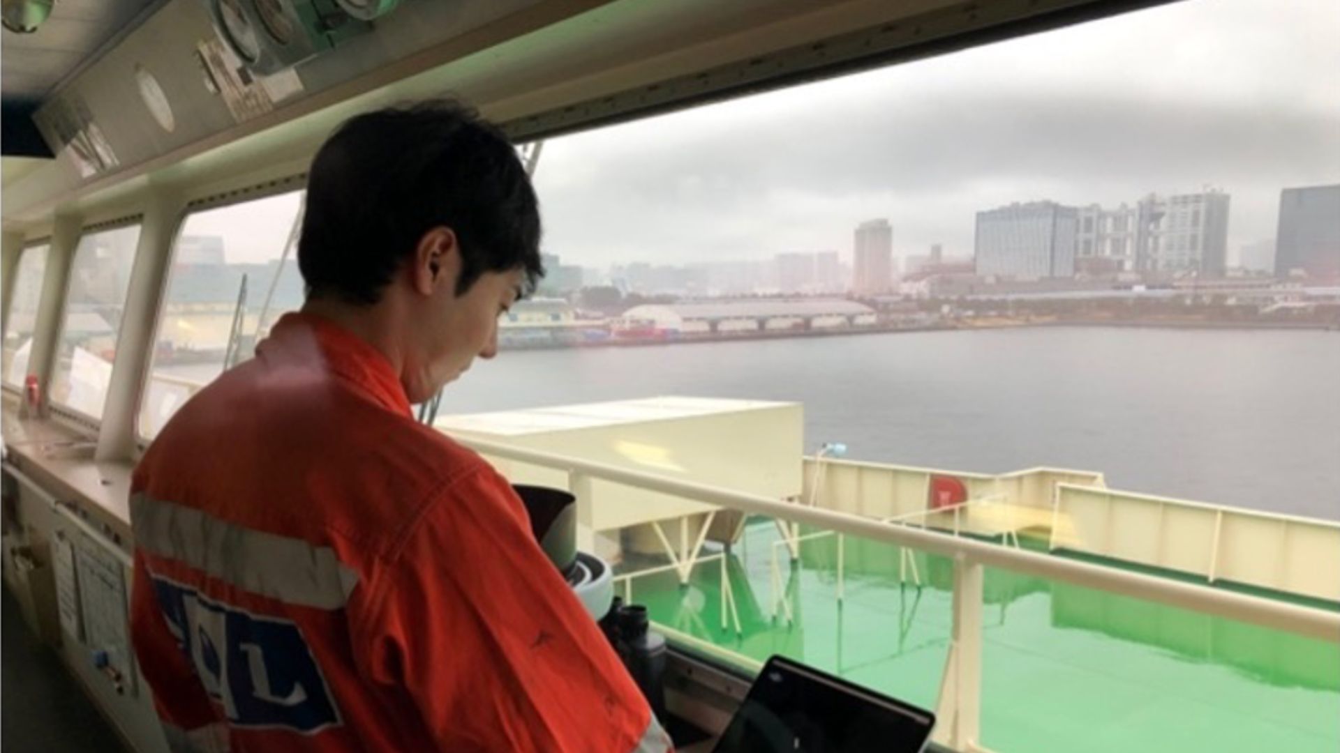
Metro Weather was introduced to us through a referral from Creact Corporation. The relationship began smoothly, with our company providing the necessary technical support and guidance throughout the integration process. After studying Metro Weather’s requirements, Kyoki, our sales manager for Japan, suggested Ellipse-D for its low power consumption and high accuracy.
Significant improvements after product integration
Ellipse-D provided the perfect solution by providing accurate motion speed and tilt data that could be used to adjust the LiDAR readings for true wind speed.
By integrating our INS technology, Metro Weather has significantly improved its wind condition observation capabilities:
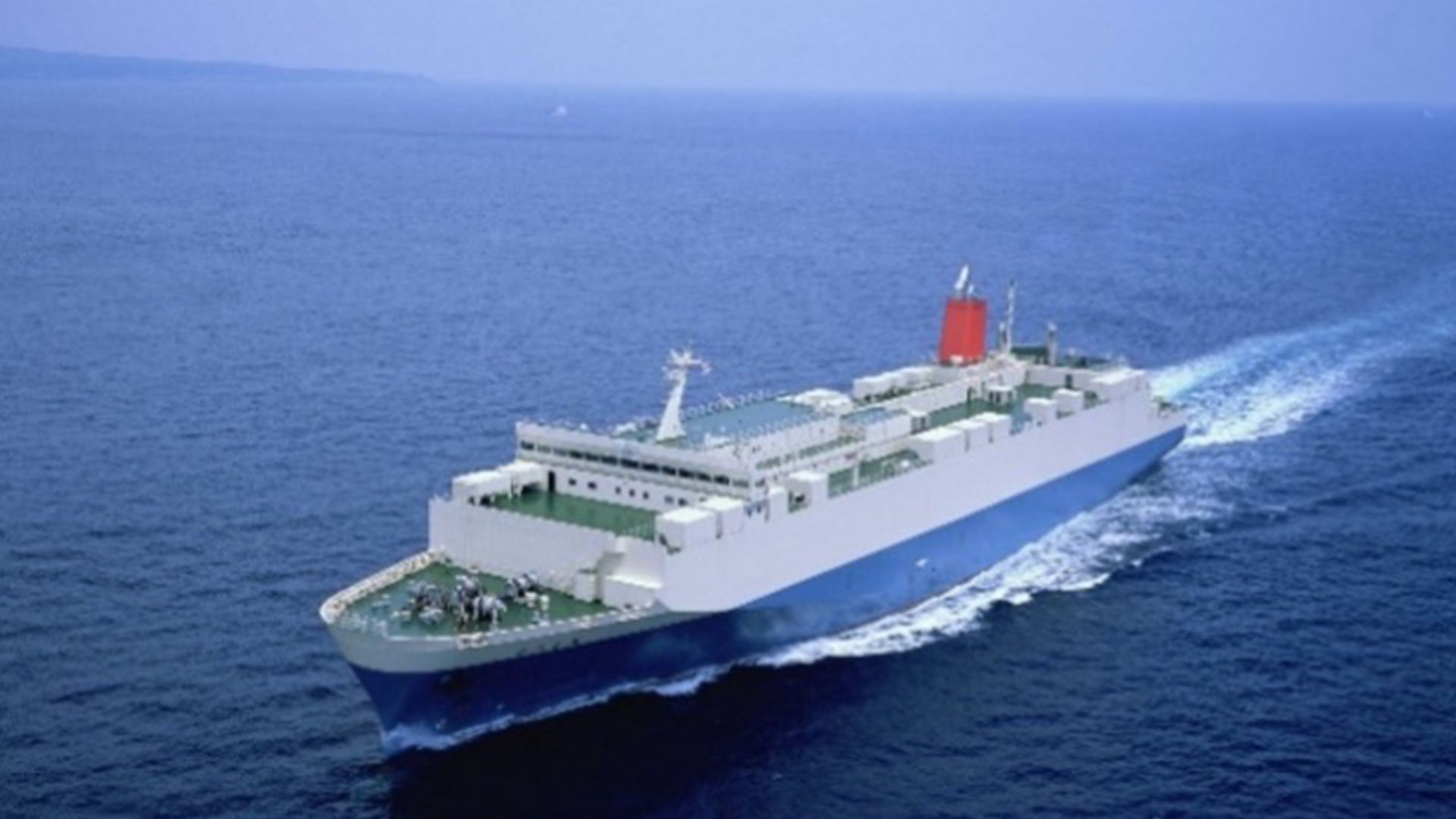
- Accurate wind speed measurement: The Doppler LiDAR installed on moving objects, such as ships, previously faced challenges in accurately calculating wind speed due to the added motion speed. Our Ellipse-D provided the necessary data to subtract the motion speed from the observed values, ensuring accurate wind speed measurement.
- Improved data accuracy: Ellipse-D also provided data on the tilt and inclination of the moving object. This allowed Metro Weather to adjust the angle of the laser beam accordingly, maintaining high measurement accuracy regardless of platform movement.
- Increased product value: The addition of SBG Systems’ technology increased the overall value and marketability of Metro Weather’s solutions.
- Valuable meteorological data collection: Ellipse-D enabled the collection of accurate meteorological data by installing Doppler LiDAR on ships. This allowed comprehensive wind speed data to be collected at low altitude over the sea in a radius of 15 km and a diameter of 30 km, areas where actual measurements were previously almost non-existent.
Support and collaboration
Metro Weather received comprehensive support from our Support team throughout the integration process. This included:
- Access to a well-documented software library.
- Prompt resolution of technical issues through email, online meetings, and on-site visits by our engineers.
- Continued collaboration to address ongoing challenges, such as the rotation of azimuth when installed on ships.
Positive feedback
Metro Weather highlighted several key benefits of working with us:
- The measurable improvement in product value.
- The exceptional quality and performance of our INS Ellipse-D.
- The outstanding support and professionalism of our Sales and Support teams.
We remain committed to supporting Metro Weather as they continue to expand their capabilities in high-precision wind condition observation.
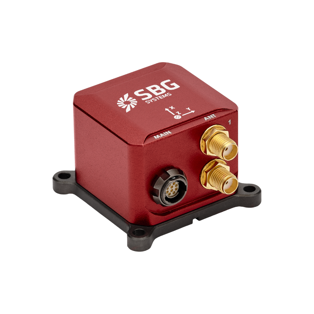
Ellipse-D
The Ellipse-D is an inertial navigation system integrating a dual antenna and dual frequency RTK GNSS that is compatible with our Post-Processing software Qinertia.
Designed for robotic and geospatial applications, it can fuse Odometer input with Pulse or CAN OBDII for enhanced dead-reckoning accuracy.
Ask a quotation for Ellipse-D
Do you have questions?
Welcome to our FAQ section! Here, you’ll find answers to the most common questions about the applications we showcase. If you don’t find what you’re looking for, feel free to contact us directly!
What is GNSS vs GPS?
GNSS stands for Global Navigation Satellite System and GPS for Global Positioning System. These terms are often used interchangeably, but they refer to different concepts within satellite-based navigation systems.
GNSS is a collective term for all satellite navigation systems, while GPS refers specifically to the U.S. system. It includes multiple systems that provide more comprehensive global coverage, while GPS is just one of those systems.
You get improved accuracy and reliability with GNSS, by integrating data from multiple systems, whereas GPS alone might have limitations depending on satellite availability and environmental conditions.
What is GNSS post-processing?
GNSS post-processing, or PPK, is an approach where the raw GNSS data measurements logged on a GNSS receiver are processed after the data acquisition activity. They can be combined with other sources of GNSS measurements to provide the most complete and accurate kinematic trajectory for that GNSS receiver, even in the most challenging environments.
These other sources can be local GNSS base station at or near the data acquisition project, or existing continuously operating reference stations (CORS) typically offered by governmental agencies and/or commercial CORS network providers.
A Post-Processing Kinematic (PPK) software can make use of freely available GNSS satellite orbit and clock information, to help further improve the accuracy. PPK allow for precise determination of a local GNSS base station’s location in an absolute global coordinate reference frame datum, which is used.
PPK software can also support complex transformations between different coordinate reference frames in support of engineering projects.
In other words, it gives access to corrections, enhances the project’s accuracy, and can even repair data losses or errors during the survey or installation after the mission.
Does INS accept inputs from external aiding sensors?
Inertial Navigation Systems from our company accept inputs from external aiding sensors, such as air data sensors, magnetometers, Odometers, DVL and other.
This integration makes the INS highly versatile and reliable, especially in GNSS-denied environments.
These external sensors enhance the overall performance and accuracy of the INS by providing complementary data.
What is the difference between IMU and INS?
The difference between an Inertial Measurement Unit (IMU) and an Inertial Navigation System (INS) lies in their functionality and complexity.
An IMU (inertial measuring unit) provides raw data on the vehicle’s linear acceleration and angular velocity, measured by accelerometers and gyroscopes. It supplies information on roll, pitch, yaw, and motion, but does not compute position or navigation data. The IMU is specifically designed to relay essential data about movement and orientation for external processing to determine position or velocity.
On the other hand, an INS (inertial navigation system) combines IMU data with advanced algorithms to calculate a vehicle’s position, velocity, and orientation over time. It incorporates navigation algorithms like Kalman filtering for sensor fusion and integration. An INS supplies real-time navigation data, including position, velocity, and orientation, without relying on external positioning systems like GNSS.
This navigation system is typically utilized in applications that require comprehensive navigation solutions, particularly in GNSS-denied environments, such as military UAVs, ships, and submarines.
