PingDSP integrates Ekinox INS for its sonars
The company has selected SBG Systems inertial sensors for motion compensation and GNSS outage compensation.
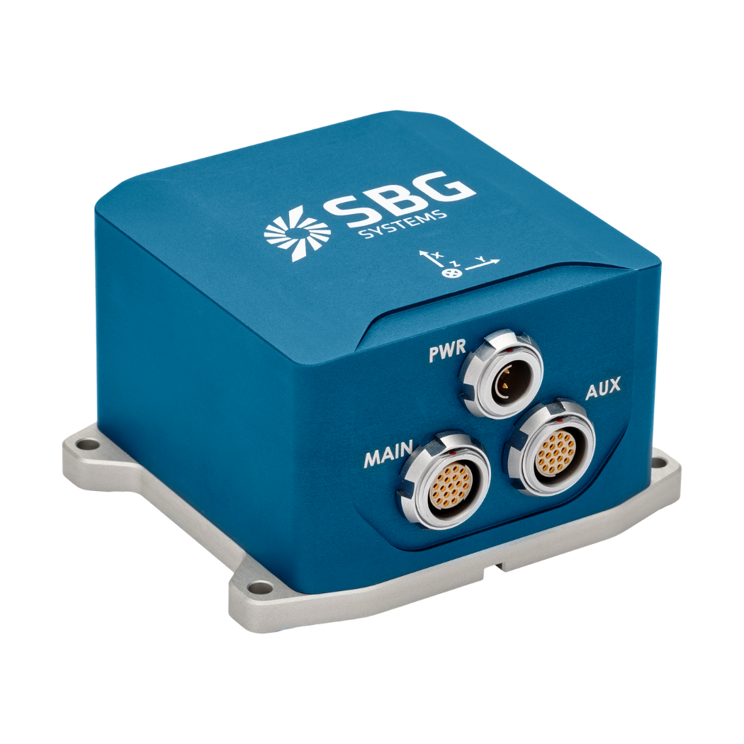
“The newly integrated Ekinox-E provides accurate sonar attitude, heading and heave information in a GNSS aided package.” | PingDSP
All about PingDSP’s sonar
The introduction of the iDX reaffirms PingDSP as the leading innovator and developer of sonar technology for shallow water hydrography and imaging.
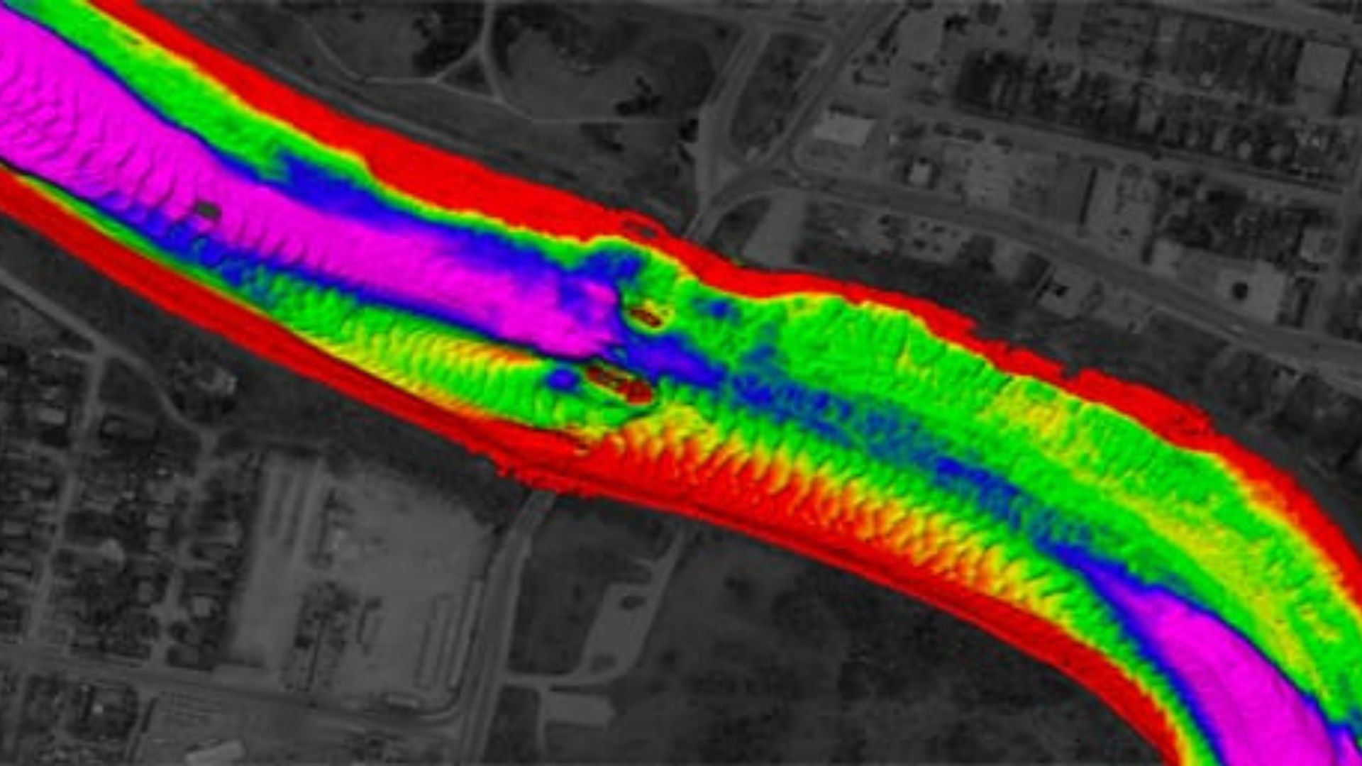
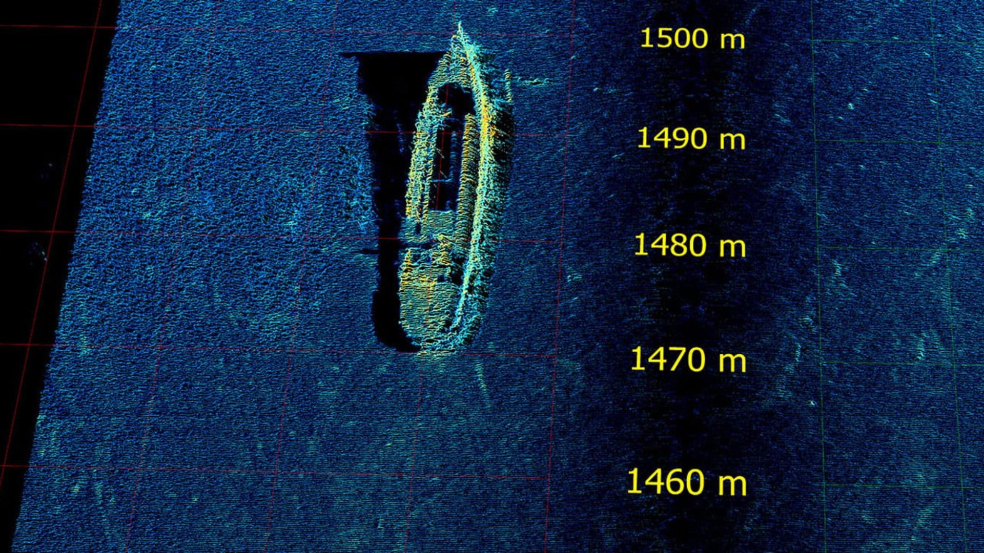
The 3DSS-iDX introduces an innovative signal processing technique that enhances traditional interferometric systems by managing multiple simultaneous backscatter arrivals, including signals from the seabed, sea surface, water column, and multipath.
This advanced approach delivers exceptional wide-swath bathymetry and true 3D sidescan imaging, all packaged in a compact and user-friendly sonar system.

“Performance, versatility and simplicity, that’s what shallow water hydrographers want, and that’s exactly what the 3DSS‐iDX is all about”, says Dr. Paul Kraeutner”, PingDSP’s founder and CEO.
Integrated Ekinox-E
The newly integrated Ekinox-E provides accurate sonar attitude, heading and heave information in a GNSS aided package. While the recently unveiled AML MicroX SVT probe provides accurate sound velocity at the transducer face for seamless real‐time angle corrections.
A seamless integration
The PingDSP engineering team worked closely with both SBG Systems and AML Oceanographic to provide seamless integration of hydrography grade peripherals into the iDX sonar head, significantly reducing both installation and operating complexity.


Ekinox-E
Ekinox-E additionally accepts aiding data from external GNSS receiver to provide navigation.
The Ekinox-E has been designed to connect up to 4 external aiding systems, including DVL or DMI. This highly versatile inertial navigation system provides orientation, heave, and navigation data.

Ask a quotation for Ekinox-E
Do you have questions?
Welcome to our FAQ section! Here, you’ll find answers to the most common questions about the applications we showcase. If you don’t find what you’re looking for, feel free to contact us directly!
What is bathymetry?
Bathymetry is the study and measurement of the depth and shape of underwater terrain, primarily focused on mapping the seafloor and other submerged landscapes. It is the underwater equivalent of topography, providing detailed insights into the underwater features of oceans, seas, lakes, and rivers. Bathymetry plays a crucial role in various applications, including navigation, marine construction, resource exploration, and environmental studies.
Modern bathymetric techniques rely on sonar systems, such as single-beam and multibeam echo sounders, which use sound waves to measure water depth. These devices send sound pulses toward the seafloor and record the time it takes for the echoes to return, calculating depth based on the speed of sound in water. Multibeam echo sounders, in particular, allow for wide swaths of the seafloor to be mapped at once, providing highly detailed and accurate seafloor representations. Frequently, a RTK + INS solution is associated to create accurately positioned 3D bathymetric representations of the seafloor.
Bathymetric data is essential for creating nautical charts, which help guide vessels safely by identifying potential underwater hazards like submerged rocks, wrecks, and sandbanks. It also plays a vital role in scientific research, helping researchers understand underwater geological features, ocean currents, and marine ecosystems.
What is the inertial guidance system of a USV?
An inertial guidance system for an Unmanned Surface Vehicle (USV) is crucial for precise navigation and control, especially when GNSS is unavailable. Inertial sensors track motion and orientation, enabling effective navigation in challenging environments.
Inertial Navigation Systems (INS) integrate IMU data with other systems, such as GNSS or Doppler Velocity Logs, for enhanced accuracy. They also employ navigation algorithms, such as Kalman Filtering, to calculate position and velocity.
Inertial sensors support autonomous operation, providing accurate heading and position data for various applications. They ensure effective operation in GNSS-denied conditions and allow real-time adjustments for enhanced maneuverability.
What is Multibeam Echo Sounding?
Multibeam Echo Sounding (MBES) is an advanced hydrographic surveying technique used to map the seafloor and underwater features with high precision.
Unlike traditional single-beam echo sounders that measure depth at a single point directly beneath the vessel, MBES utilizes an array of sonar beams to simultaneously capture depth measurements across a wide swath of the seafloor. This allows for detailed, high-resolution mapping of underwater terrain, including topography, geological features, and potential hazards.
MBES systems emit sound waves that travel through the water, bouncing off the seafloor and returning to the vessel. By analyzing the time it takes for the echoes to return, the system calculates the depth at multiple points, creating a comprehensive map of the underwater landscape.
This technology is essential for various applications, including navigation, marine construction, environmental monitoring, and resource exploration, providing critical data for safe maritime operations and sustainable management of marine resources.
What is hydrographic surveying?
Hydrographic surveying is the process of measuring and mapping physical features of bodies of water, including oceans, rivers, lakes, and coastal areas. It involves collecting data related to the depth, shape, and contours of the seafloor (seafloor mapping), as well as the location of submerged objects, navigational hazards, and other underwater features (e.g. water trenches). Hydrographic surveying is crucial for various applications, including navigation safety, coastal management and coastal survey, construction, and environmental monitoring.
Hydrographic surveying involves several key components, starting with bathymetry, which measures water depth and seafloor topography using sonar systems like single-beam or multi-beam echo sounders that send sound pulses to the seafloor and measure the echo’s return time.
Accurate positioning is critical, achieved using Global Navigation Satellite Systems (GNSS) and Inertial Navigation Systems (INS) to link depth measurements to precise geographic coordinates. Additionally, water column data, such as temperature, salinity, and currents, are measured, and geophysical data is collected to detect underwater objects, obstacles, or hazards using tools like side-scan sonar and magnetometers.
